The Ultimate Guide to Hiking in Arizona: Trails, Tips & Hidden Gems Across the Grand Canyon State
From Camelback Mountain to the Grand Canyon, Arizona offers some of the most diverse and rewarding hiking in the country. This guide covers the best trails by region, with difficulty ratings, seasonal advice, and links to every trailhead and state park.
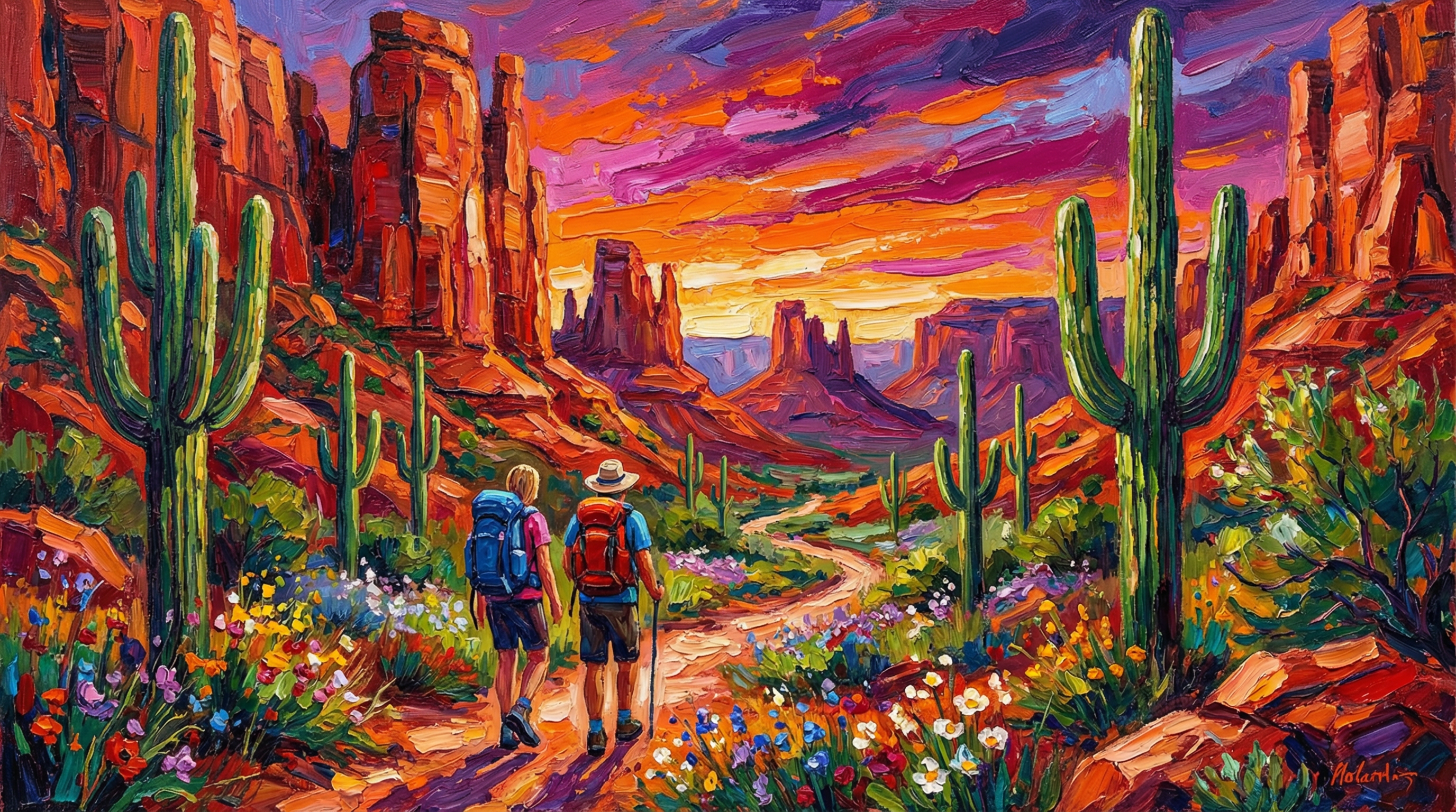
Arizona is, quite simply, one of the greatest hiking destinations on the planet. No other state offers the sheer diversity of terrain that Arizona packs into its 113,990 square miles — from the mile-deep chasm of the Grand Canyon to the saguaro forests of the Sonoran Desert, from the alpine meadows of the San Francisco Peaks to the red rock spires of Sedona. There are trails here for every fitness level, every season, and every definition of "beautiful," and the state's 300-plus days of sunshine mean the weather is almost always cooperating somewhere.
This guide covers Arizona's best hiking trails organized by region, with honest difficulty ratings, seasonal advice, and links to every trailhead, state park, and outdoor resource you will need to plan your next adventure. Whether you are training for a Grand Canyon rim-to-rim or looking for an easy sunset stroll with the dog, Arizona has a trail waiting for you.
Explore Arizona outdoors: Visit the SeekZona State Parks directory for maps and details on every state park, or browse Pet-Friendly Trails if you are hiking with your four-legged companion.
Phoenix Metro: Desert Peaks & Urban Escapes
The Phoenix metropolitan area is home to some of the most accessible and rewarding desert hiking in the country. Mountain preserves and regional parks are woven into the fabric of the city, meaning you can be on a trail within 15 minutes of almost any Valley neighborhood.
Camelback Mountain
Arizona's most iconic urban hike, Camelback Mountain, rises 2,704 feet above the heart of Phoenix and Scottsdale. Two trails reach the summit:
-
Echo Canyon Trail: The steeper, more popular route at 1.2 miles one way with 1,280 feet of elevation gain. Expect scrambling over boulders and using handrails on the upper sections. The views from the summit — spanning the entire Valley from the Superstition Mountains to the White Tanks — are worth every bead of sweat.
-
Cholla Trail: Slightly longer at 1.5 miles but with a more gradual approach before a steep final push. Less crowded than Echo Canyon, especially on weekday mornings.
Difficulty: Strenuous | Best season: October – April | Tip: Start before sunrise to beat the heat and the crowds.
Piestewa Peak
Piestewa Peak - Freedom Trail is the second-most-popular summit hike in Phoenix, and many locals prefer it to Camelback for its slightly shorter but equally rewarding climb. The 1.2-mile Freedom Trail gains 1,190 feet to a rocky summit with 360-degree views. The trail is well-maintained with stone steps, but the final stretch is steep and exposed.
Difficulty: Strenuous | Best season: October – April | Tip: The parking lot fills by 7 AM on weekends — arrive early or take the shuttle.
Tom's Thumb Trail
Tom's Thumb Trail in the McDowell Sonoran Preserve is a Scottsdale favorite. The 4.4-mile out-and-back trail climbs through a beautiful desert landscape of granite boulders and saguaro cacti to a massive rock formation that resembles a hitchhiker's thumb. The trail is well-marked and offers excellent views of the McDowell Mountains and Four Peaks.
Difficulty: Moderate to strenuous | Best season: October – April | Tip: Combine with a visit to the McDowell Sonoran Preserve gateway trailheads for additional loop options.
Pinnacle Peak Trail
Pinnacle Peak Trail in north Scottsdale is one of the best moderate hikes in the Valley. The 3.5-mile out-and-back trail follows a well-graded path along the base of Pinnacle Peak, with sweeping views of the McDowell Mountains, Four Peaks, and the Valley below. It is an excellent choice for families and visitors looking for a scenic desert hike without the extreme elevation gain of Camelback.
Difficulty: Moderate | Best season: Year-round (early morning in summer) | Tip: The trail closes at sunset — check posted hours.
More Phoenix Metro Trails
| Trail | Location | Distance | Difficulty |
|---|---|---|---|
| Papago Park Trails | Phoenix/Tempe | Various loops | Easy |
| South Mountain - National Trail | Phoenix | 14.3 miles | Moderate–Strenuous |
| Dreamy Draw Recreation Area | Phoenix | Various | Easy–Moderate |
| Sunrise Trail | Fountain Hills | 4.6 miles | Moderate |
| Fountain Hills McDowell Mountain Park | Fountain Hills | Various | Easy–Moderate |
| San Tan Mountain Regional Park | Queen Creek | Various | Easy–Moderate |
| Estrella Mountain Regional Park | Goodyear | Various | Easy–Moderate |
| White Tank Mountain Regional Park | Waddell | Various | Easy–Moderate |
| Cave Creek Regional Park | Cave Creek | Various | Easy–Moderate |
| Usery Mountain Regional Park | Mesa | Various | Easy–Moderate |
Superstition Mountains: Where Legends Meet Trails
The Superstition Mountains east of Apache Junction are among Arizona's most dramatic and storied landscapes. These rugged volcanic peaks are home to the legend of the Lost Dutchman's Gold Mine and some of the most challenging — and rewarding — hiking in the state.
Flatiron via Siphon Draw Trail
Flatiron via Siphon Draw Trail is one of Arizona's most iconic and challenging day hikes. The 5.6-mile out-and-back trail climbs 2,800 feet from the desert floor to the top of the Flatiron, a massive rock formation with jaw-dropping views of the Superstition Wilderness. The final section involves Class 3 scrambling up a steep boulder field — this is not a trail for beginners.
Difficulty: Very strenuous | Best season: November – March | Tip: Start from Lost Dutchman State Park for the best trailhead access and facilities.
Peralta Trail to Fremont Saddle
Peralta Trail to Fremont Saddle is the most popular trail in the Superstitions and for good reason — the view of Weaver's Needle from Fremont Saddle is one of the most photographed scenes in Arizona. The 4.6-mile out-and-back trail gains 1,350 feet through a beautiful canyon lined with saguaros and jojoba.
Difficulty: Moderate to strenuous | Best season: October – April | Tip: The parking lot at Peralta Trailhead fills early on weekends — a Tonto Pass is required.
Hieroglyphic Trail
Hieroglyphic Trail is a family-friendly 2.8-mile out-and-back trail that leads to a panel of ancient Hohokam petroglyphs carved into the rock. The trail is relatively flat with gentle elevation gain, making it one of the best easy hikes in the Superstition foothills. After rain, a seasonal waterfall flows near the petroglyphs.
Difficulty: Easy to moderate | Best season: October – April | Tip: Bring binoculars to study the petroglyphs up close without touching them.
Sedona: Red Rock Country
Sedona's red rock formations are among the most visually stunning landscapes in the world, and the hiking here matches the scenery. Trails wind through crimson canyons, past towering buttes, and along creeks shaded by ancient sycamores. The Coconino National Forest surrounds the town and provides hundreds of miles of trails.
Cathedral Rock Trail
Cathedral Rock Trail is Sedona's signature hike — a short but steep scramble up one of the most photographed rock formations in Arizona. The 1.2-mile out-and-back trail gains 740 feet, with the final section requiring hands-on scrambling up slickrock. The views from the saddle between the twin spires are unforgettable, especially at sunset.
Difficulty: Strenuous (short but steep) | Best season: Year-round | Tip: Arrive before sunrise for the best light and smallest crowds.
Devil's Bridge Trail
Devil's Bridge Trail leads to the largest natural sandstone arch in the Sedona area. The 4.2-mile out-and-back trail (from the main parking area) is moderate in difficulty, with a steep final climb to the bridge itself. Standing on the bridge with red rock canyons dropping away on both sides is a bucket-list Arizona moment.
Difficulty: Moderate | Best season: Year-round | Tip: The trail is extremely popular — start early or go on a weekday.
Bell Rock Trail
Bell Rock Trail is one of Sedona's most accessible hikes, circling the base of the iconic bell-shaped butte. The 3.6-mile loop is mostly flat and well-maintained, making it perfect for families and casual hikers. For more adventure, scramble up the lower slopes of Bell Rock for elevated views.
Difficulty: Easy (loop) to moderate (scramble) | Best season: Year-round | Tip: Combine with the Courthouse Butte loop for a longer 5-mile circuit.
Boynton Canyon Trail
Boynton Canyon Trail is a 6.1-mile out-and-back trail that winds through a beautiful box canyon surrounded by towering red and white cliffs. The trail passes through a mix of desert and riparian vegetation, with several side trails leading to ancient cliff dwellings and vortex sites. It is one of Sedona's most peaceful and varied hikes.
Difficulty: Moderate | Best season: Year-round | Tip: Take the short spur trail to the Boynton Canyon Vortex for panoramic views.
West Fork Oak Creek Trail
West Fork Oak Creek Trail is widely considered one of the most beautiful hikes in Arizona. The 6.4-mile out-and-back trail follows Oak Creek through a narrow canyon, crossing the creek 13 times on stepping stones. In autumn, the canyon explodes with golden cottonwoods and red maples — it is the closest thing to New England fall foliage you will find in the Southwest.
Difficulty: Easy to moderate | Best season: Fall (October) for colors; spring for wildflowers | Tip: A Red Rock Pass is required for parking. Arrive before 9 AM in fall — the lot fills and closes.
Wilson Mountain Trail
Wilson Mountain Trail is Sedona's highest summit hike, climbing 2,300 feet over 5.6 miles to the top of Wilson Mountain at 7,122 feet. The trail offers commanding views of the entire Sedona red rock landscape, Oak Creek Canyon, and the Mogollon Rim. It is a full-day commitment and the most strenuous mainstream hike in Sedona.
Difficulty: Very strenuous | Best season: April – November | Tip: Carry extra water — there is no shade on the upper sections.
Flagstaff & Northern Arizona: Mountain Trails & Alpine Meadows
Northern Arizona's high country offers a completely different hiking experience from the desert — cool pine forests, alpine meadows, and Arizona's highest peaks. The Prescott National Forest and Coconino National Forest provide hundreds of miles of trails.
Humphreys Peak Trail
Humphreys Peak Trail is the hike to Arizona's highest point at 12,637 feet. The 10-mile out-and-back trail climbs 3,333 feet through spruce-fir forest and above treeline to the rocky summit, where views extend across the Painted Desert, the Grand Canyon rim, and the volcanic fields of northern Arizona. This is a serious mountain hike that demands respect — afternoon thunderstorms are common in summer, and the trail is snow-covered from November through May.
Difficulty: Very strenuous | Best season: June – October | Tip: Start by 6 AM to summit before afternoon storms build. Carry layers — temperatures can drop 30 degrees from trailhead to summit.
Weatherford Trail
Weatherford Trail is a longer, more gradual approach to the San Francisco Peaks that avoids the crowds on Humphreys. The 10.4-mile one-way trail (often done as a shuttle) winds through aspen groves and meadows, connecting to the Humphreys Peak Trail near the summit. In fall, the aspens along this trail turn brilliant gold.
Difficulty: Strenuous (length) | Best season: June – October | Tip: Best done as a point-to-point with a car shuttle.
Grand Canyon: The Ultimate Arizona Hike
No hiking guide to Arizona would be complete without the Grand Canyon. While rim-to-rim and multi-day backpacking trips are legendary, the two main corridor trails offer incredible day-hiking opportunities.
Bright Angel Trail
Bright Angel Trail is the Grand Canyon's most popular trail, descending 4,380 feet over 9.5 miles from the South Rim to the Colorado River. Most day hikers turn around at one of the rest houses — the 1.5-Mile Resthouse or 3-Mile Resthouse — for a rewarding out-and-back experience without committing to the full descent.
Difficulty: Strenuous to very strenuous | Best season: Spring and fall | Tip: Do not attempt to hike to the river and back in a single day — the National Park Service strongly advises against it, especially in summer.
South Kaibab Trail
South Kaibab Trail is steeper and more exposed than Bright Angel but offers superior views. The trail follows a ridge rather than a canyon, providing panoramic vistas at every turn. Ooh Aah Point (0.9 miles) and Cedar Ridge (1.5 miles) are popular turnaround points for day hikers.
Difficulty: Strenuous | Best season: Spring and fall | Tip: There is no water on this trail — carry everything you need. Take the free shuttle from the Visitor Center to the trailhead.
Tucson & Southern Arizona: Saguaro Country
Southern Arizona offers a unique hiking experience among the world's densest saguaro forests, sky island mountain ranges, and desert canyons.
Saguaro National Park
Saguaro National Park East and Saguaro National Park West together protect over 91,000 acres of Sonoran Desert landscape. The Rincon Mountain District (east) offers more strenuous backcountry trails, while the Tucson Mountain District (west) has easier trails through dense saguaro forests.
Catalina State Park
Catalina State Park at the base of the Santa Catalina Mountains offers several excellent trails, including the Romero Canyon Trail and the Birding Trail. The park is a gateway to the Pusch Ridge Wilderness and the Romero Pools Trail, a beautiful 5.6-mile out-and-back to seasonal swimming pools in the canyon.
More Tucson Trails
| Trail | Distance | Difficulty | Highlight |
|---|---|---|---|
| Seven Falls Trail | 8.2 miles | Moderate | Seasonal waterfalls in Bear Canyon |
| Ventana Canyon Trail | 12 miles | Strenuous | Window Rock formation |
| Wasson Peak via King Canyon | 7.4 miles | Moderate | Highest point in Tucson Mountains |
Payson & the Mogollon Rim
The Mogollon Rim — a 200-mile escarpment that divides Arizona's desert lowlands from its forested highlands — offers some of the state's most underrated hiking. The town of Payson sits at the base of the Rim and serves as a gateway to trails through pine forests, along creeks, and to stunning rim-edge viewpoints.
Fossil Springs Trail
Fossil Springs Trail descends from the Rim to one of Arizona's most spectacular natural springs, where 20,000 gallons of 72-degree water flow per minute into a series of turquoise pools. The 4-mile one-way trail drops 1,500 feet through a beautiful canyon. Swimming in the travertine pools at the bottom is the reward.
Difficulty: Moderate (strenuous on the return climb) | Best season: Spring and fall | Tip: A permit is required from April through October — reserve online through Recreation.gov.
Hiking with Dogs in Arizona
Arizona is one of the most dog-friendly hiking states in the country. Most trails in national forests and regional parks allow leashed dogs, and several are specifically managed for off-leash hiking. SeekZona maintains a comprehensive Pet-Friendly Trails directory with 40 trails rated for dog-friendliness.
Top dog-friendly trails:
- Butcher Jones Trail — lakeside trail at Saguaro Lake with swimming access for dogs
- Papago Park Trails — easy loops near Tempe with shade and water
- Cave Creek Regional Park — desert trails with off-leash areas
- Prescott National Forest — miles of forest trails where dogs can explore
Find dog-friendly trails near you: Browse the complete Pet-Friendly Trails and Dog Parks directories on SeekZona.
Essential Hiking Tips for Arizona
Water & Heat Safety
Arizona's desert heat is no joke. Hikers die every year from heat-related illness, almost always because they underestimated the conditions. Follow these rules:
- Carry at least one liter of water per hour of hiking in temperatures above 80°F
- Start early — be on the trail by sunrise in summer months
- Know the signs of heat exhaustion: dizziness, nausea, headache, rapid pulse
- Never hike alone in remote areas during summer
- Check trail closures — Phoenix closes Camelback and Piestewa Peak trails when temperatures exceed 110°F
What to Bring
- Sun protection: hat, sunscreen, sunglasses
- Proper footwear: hiking boots or trail shoes with good traction
- Navigation: downloaded trail map (cell service is unreliable on many Arizona trails)
- First aid kit with blister treatment
- Snacks with electrolytes
Wildlife Awareness
Arizona trails are home to rattlesnakes, Gila monsters, scorpions, and javelinas. Stay on marked trails, watch where you step and place your hands, and give wildlife a wide berth. Encounters are rare and almost always avoidable with basic awareness.
Seasonal Hiking Guide
| Season | Best Regions | What to Expect |
|---|---|---|
| Spring (Mar–May) | Desert trails, Superstitions, Sedona | Wildflowers, perfect temperatures, busy trails |
| Summer (Jun–Aug) | Flagstaff, White Mountains, Mogollon Rim | Escape the heat at elevation; monsoon storms in afternoon |
| Fall (Sep–Nov) | Sedona (aspens), Flagstaff, Prescott | Fall colors, cooling desert temps, ideal conditions |
| Winter (Dec–Feb) | Phoenix metro, Tucson, Superstitions | Mild desert weather, snow on northern trails |
Combine Hiking with Other Arizona Adventures
A great hike deserves a great meal and a cold drink afterward. Here are some ways to extend your Arizona outdoor adventure:
- Post-hike dining: Check out Arizona's Best Restaurants or grab a quick bite from an Arizona Food Truck
- Craft beverages: Reward yourself with a local brew from one of Arizona's Best Breweries & Wineries
- Fishing: Many hiking areas are near excellent fishing lakes — bring a rod and make it a full outdoor day
- Golf: Arizona's world-class golf courses pair perfectly with a morning hike
- Water sports: After a hot desert hike, cool off with kayaking or paddleboarding on a nearby lake
- Spring Training: Visiting in February or March? Combine hiking with Cactus League baseball
- State Parks: Many of Arizona's best trails are inside state parks that also offer camping, fishing, and wildlife viewing
Frequently Asked Questions
What is the best hike in Arizona for beginners? Papago Park Trails in Phoenix and Bell Rock Trail in Sedona are both excellent beginner-friendly options with stunning scenery and minimal elevation gain.
When is the best time to hike in Arizona? October through April is ideal for desert trails (Phoenix, Tucson, Superstitions). June through October is best for mountain trails (Flagstaff, White Mountains, Grand Canyon). Sedona is hikeable year-round.
Do I need a pass to hike in Arizona? Most city and county parks are free. National Forest trails in Sedona require a Red Rock Pass ($5/day). Some state parks charge per-vehicle entrance fees. The Grand Canyon requires a park entrance fee.
Can I hike with my dog in Arizona? Yes — most national forest and regional park trails allow leashed dogs. National parks (Grand Canyon, Saguaro) generally do not allow dogs on trails. Check the Pet-Friendly Trails directory for dog-approved trails.
How do I avoid rattlesnakes on Arizona trails? Stay on marked trails, watch where you step, avoid reaching into crevices or under rocks, and hike during cooler morning hours when snakes are less active. If you see a rattlesnake, give it at least six feet of space and walk around it.
Ready to hit the trail? Browse the complete Pet-Friendly Trails and State Parks directories on SeekZona for maps, photos, and details on every trail and park in Arizona. And after your hike, explore our guides to Arizona's best restaurants, hidden gem eateries, and craft breweries for the perfect post-hike meal.